Showing posts with label California. Show all posts

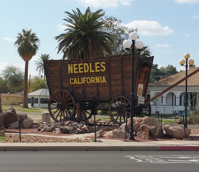
The Dying City of Needles, California

Urban exploration of the dying town of Needles, CA along Route 66

The adrenaline rush from exploring Amboy had ended, and I was ready to grab a bite to eat and then hit the hay. Since Roy's Cafe no longer had a functioning kitchen, I hadn't eaten since Twentynine Palms.

I stopped at Wagon Wheel Restaurant in Needles, which had good reviews on Yelp. At 9 pm I was the only guest, but I didn't mind the quiet. The place had a charming, comfortable atmosphere with walls covered in humorous signage and Route 66 memorabilia. The waitress was a sweet woman with a twang in her voice. She called me "darlin'", which I found endearing.

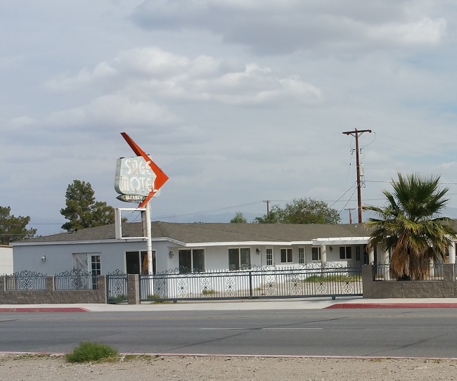
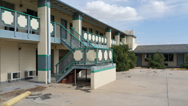
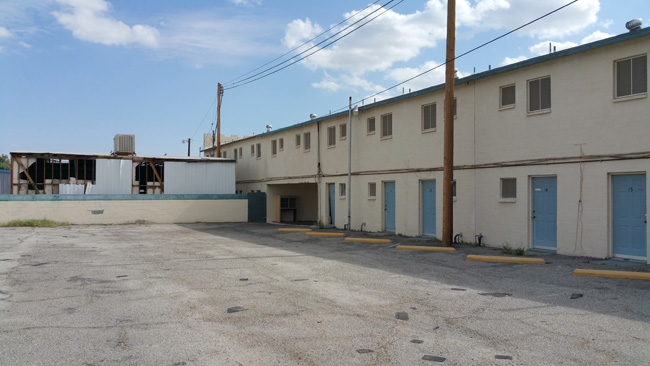
After a delicious meal I considered getting a room, since I'd spent every night in the car. A lot of the motels had flashing signs advertising rates as low as $38.95 per night, but the reviews on Yelp were all fairly negative. I drove past a few that had closed and now sat abandoned, so I made a mental note to explore them in the morning. I ended up parking at a truck stop for the night.

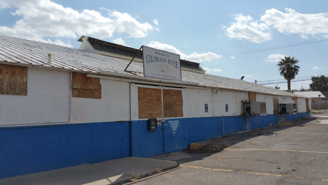
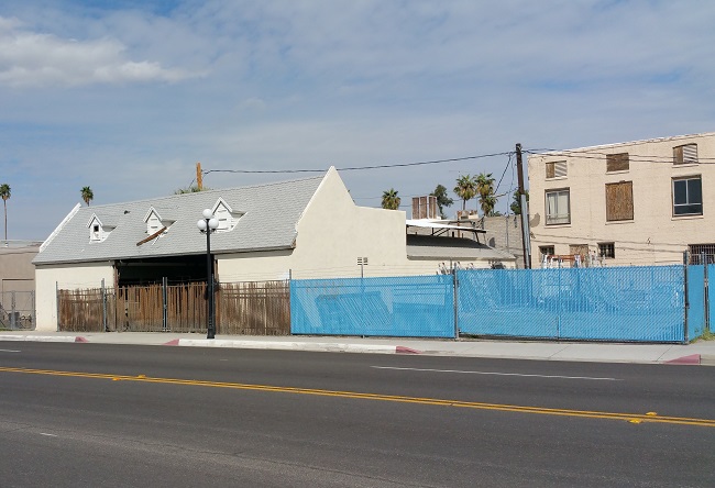
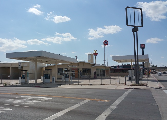
In the light of morning I got a better look at the city of Needles, and was astonished by the number of shuttered businesses.

Urban exploration of the dying town of Needles, CA along Route 66

Urban exploration of the dying town of Needles, CA along Route 66

Urban exploration of the dying town of Needles, CA along Route 66

Urban exploration of the dying town of Needles, CA along Route 66

Urban exploration of the dying town of Needles, CA along Route 66

Urban exploration of the dying town of Needles, CA along Route 66

Named for the nearby pointed mountain peaks, Needles was founded in 1883 to support the Atchison, Topeka and Santa Fe Railway. The city's location along the Western bank of the Colorado River, which serves as the California/Arizona border, was once its major draw. As in John Steinbeck's Grapes of Wrath, it was an important stopping point for travelers entering California in search of opportunity during the Dust Bowl era. Like the Joad family, thousands stopped in Needles for gas and supplies before crossing the Mojave Desert.

Its proximity to Arizona has since become a major factor behind the town's decline. With corporate taxes and building regulations being significantly higher in California, many large businesses such as Walmart, Kmart, and Home Depot have chosen to open stores in Bullhead City, AZ, only a 20-minute drive from Needles. And for savvy travelers who know that gas is often a dollar per gallon cheaper east of the Colorado River, the decision to stop for fuel and lunch in Bullhead City instead of Needles in a no-brainer.
Urban exploration of the dying town of Needles, CA along Route 66

Urban exploration of the dying town of Needles, CA along Route 66
Neat old Texaco station in Needles, CA

Urban exploration of the dying town of Needles, CA along Route 66

Other factors contributing to the decline of Needles include extremely high poverty (nearly 29% of the population lived below the poverty line at the time of the 2010 census), crime rates well above the national average (including violent crime), higher than average unemployment rates, and a lack of clothing and grocery stores. Also during summer months, Needles is often the hottest city in the United States, and sometimes the hottest on Earth.

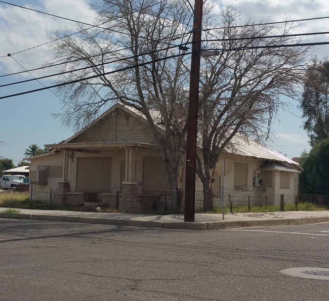
I spent hours walking around Needles, spotting vacant homes.

Urban exploration of the dying town of Needles, CA along Route 66

Urban exploration of the dying town of Needles, CA along Route 66

Urban exploration of the dying town of Needles, CA along Route 66

Urban exploration of the dying town of Needles, CA along Route 66

Urban exploration of the dying town of Needles, CA along Route 66

Urban exploration of the dying town of Needles, CA along Route 66

Urban exploration of the dying town of Needles, CA along Route 66

a shuttered burger joint,

Urban exploration of the dying town of Needles, CA along Route 66

a neat old theater with promotional signage for a movie that came out more than 4 years prior to my visit, 

Urban exploration of the dying town of Needles, CA along Route 66

Urban exploration of the dying town of Needles, CA along Route 66

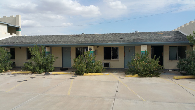
and quite a few abandoned motels.

Urban exploration of the dying town of Needles, CA along Route 66

Urban exploration of the dying town of Needles, CA along Route 66

Urban exploration of the dying town of Needles, CA along Route 66

Urban exploration of the dying town of Needles, CA along Route 66

Urban exploration of the dying town of Needles, CA along Route 66

Urban exploration of the dying town of Needles, CA along Route 66

Urban exploration of the dying town of Needles, CA along Route 66

Urban exploration of the dying town of Needles, CA along Route 66

One of the motels was not fenced off, so I had a quick peek inside. 
Urban exploration of the dying town of Needles, CA along Route 66

Urban exploration of the dying town of Needles, CA along Route 66

Urban exploration of the dying town of Needles, CA along Route 66

Urban exploration of the dying town of Needles, CA along Route 66

Urban exploration of the dying town of Needles, CA along Route 66

Urban exploration of the dying town of Needles, CA along Route 66

Urban exploration of the dying town of Needles, CA along Route 66

I was impressed to see very little graffiti anywhere in Needles. It is obvious that city officials are making an effort to keep their community free of such eyesores.

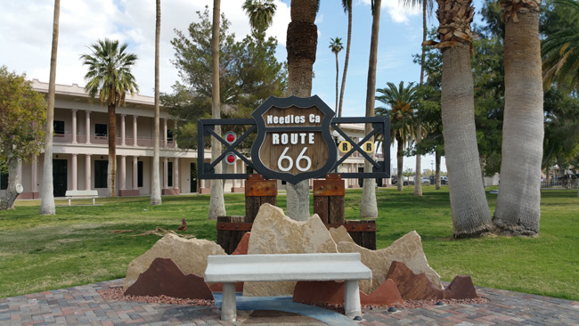
Needles has a small historic district that includes a well-manicured park,
Urban exploration of the dying town of Needles, CA along Route 66

Urban exploration of the dying town of Needles, CA along Route 66

and a museum and thrift store. 

Urban exploration of the dying town of Needles, CA along Route 66

After exploring Needes, I got back on the road and headed into Arizona, where I spent a crazy week exploring old minestrading posts, ghost towns, and many other very interesting abandonments. I even had a few run-ins with local law enforcement. 

I can't wait to tell you all about it!

Thanks for checking out this article. If you enjoyed it, please feel free to share it on Facebook. While you're at it, please subscribe to Places That Were and follow me on my social media sites:

Facebook: http://www.facebook.com/placesthatwere

Google+: https://plus.google.com/u/0/+JimSullivanPlacesThatWere/posts

EyeEm: https://www.eyeem.com/u/placesthatwere

Instagram: http://instagram.com/theplacesthatwere

Twitter: https://twitter.com/placesthatwere/

Tumblr: http://placesthatwere.tumblr.com/

Youtube: https://www.youtube.com/jimplicit

500px: https://500px.com/placesthatwere

Thank you!

Joshua Tree Petroglyphs and Wonderland Ranch

I woke up to a beautiful sunny morning and drove back to the Wall Street Mill trailhead. Wall Street Mill, considered the best-preserved gold mill in Joshua Tree National Park, once processed ore extracted from the nearby Desert Queen Mine.

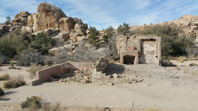
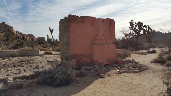
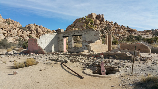
Near the beginning of the trail lay the ruins of Wonderland Ranch. Not much is known about the history of the place, except that it was built by the Ohlson family, who came to the area in search of gold.

Wonderland Ranch, aka Ohlson House in Joshua Tree National Park

Wonderland Ranch, aka Ohlson House in Joshua Tree National Park

Wonderland Ranch, aka Ohlson House in Joshua Tree National Park

  Wonderland Ranch, aka Ohlson House in Joshua Tree National Park
Vandalism of the old old structure
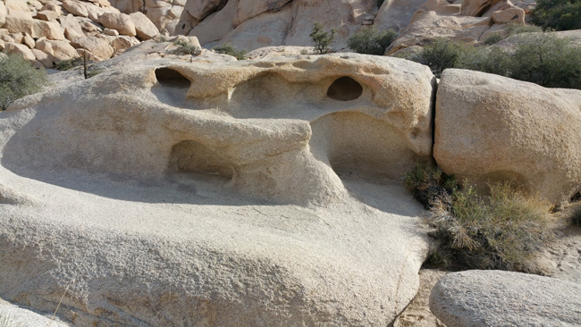
The trail to Wall Street Mill was not very clearly distinguishable from the many unofficial trails that intersected it. I lost track of it and wandered around for a while enjoying the beauty of my surroundings. Due to the mineral composition of the rocks in the area, erosion had caused some neat formations.

Rock formations resulting from erosion in Joshua Tree National Park

Rock formations resulting from erosion in Joshua Tree National Park

Rock formations resulting from erosion in Joshua Tree National Park

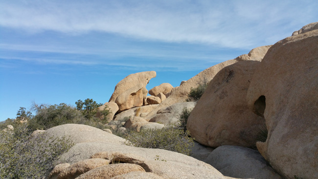
It was a very hot day, and fortunately I brought plenty of water. I climbed some steep rocky hills and looked out over the rough desert landscape.

Joshua Tree National Park landscape

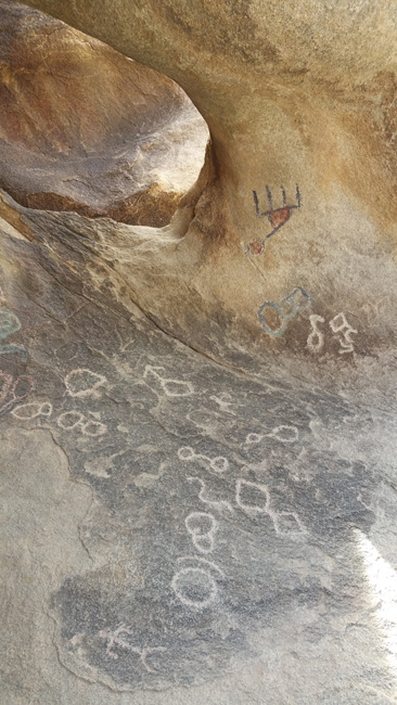
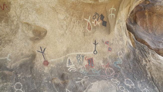
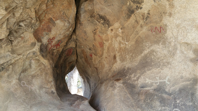
On the way back to my car I stopped to see some ancient petroglyphs left by Native Americans. Apparently there had been vandalism and some of the glyphs had been traced over with paint.

Pictographs in Joshua Tree National Park


Pictographs in Joshua Tree National Park

Pictographs in Joshua Tree National Park

Pictographs in Joshua Tree National Park

Pictographs in Joshua Tree National Park

I never ended up finding Wall Street Mill, but I didn't mind too much. Wonderland Ranch and the petroglyphs were unexpected treats and I had a good three hours of hiking.

It was time to hit the road again. With the windows down and a cool wind against my face, I said goodbye to Joshua Tree. As soon as my cell phone had reception, I pulled over to the side of the road and called my better half to tell him how much I missed him.

I made a quick stop in the military town of Twentynine Palms to refuel and grab lunch, and then headed down a long desolate road toward the ghost town of Amboy.

Thanks for checking out this article. If you enjoyed it, please feel free to share it on Facebook. While you're at it, please subscribe to Places That Were and follow me on my social media sites:

Facebook: http://www.facebook.com/placesthatwere

Google+: https://plus.google.com/u/0/+JimSullivanPlacesThatWere/posts

EyeEm: https://www.eyeem.com/u/placesthatwere

Instagram: http://instagram.com/theplacesthatwere

Twitter: https://twitter.com/placesthatwere/

Tumblr: http://placesthatwere.tumblr.com/

Youtube: https://www.youtube.com/jimplicit

500px: https://500px.com/placesthatwere

Thank you!